


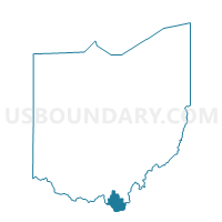
AID 1 Voting District, Lawrence County, Ohio
About
Outline

Summary
| Unique Area Identifier | 648433 |
| Name | AID 1 Voting District |
| County | Lawrence County |
| State | Ohio |
| Area (square miles) | 25.11 |
| Land Area (square miles) | 24.98 |
| Water Area (square miles) | 0.13 |
| % of Land Area | 99.47 |
| % of Water Area | 0.53 |
| Latitude of the Internal Point | 38.61959980 |
| Longtitude of the Internal Point | -82.52897210 |
Maps


Graphs
Select a template below for downloading or customizing gragh for AID 1 Voting District, Lawrence County, Ohio


Neighbors
Neighoring Voting District (by Name) Neighboring Voting District on the Map
- AID 2 Voting District, Lawrence County, OH
- ELIZABETH 1 Voting District, Lawrence County, OH
- LAWRENCE 1 Voting District, Lawrence County, OH
- LAWRENCE 3 Voting District, Lawrence County, OH
- MASON 1 Voting District, Lawrence County, OH
- MASON 2 Voting District, Lawrence County, OH
- WINDSOR 1 Voting District, Lawrence County, OH
Top 10 Neighboring County Subdivision (by Population) Neighboring County Subdivision on the Map
- Elizabeth township, Lawrence County, OH (2,969)
- Lawrence township, Lawrence County, OH (2,579)
- Windsor township, Lawrence County, OH (2,147)
- Mason township, Lawrence County, OH (1,116)
- Aid township, Lawrence County, OH (875)
Top 10 Neighboring Unified School District (by Population) Neighboring Unified School District on the Map
- Rock Hill Local School District, OH (9,416)
- Dawson-Bryant Local School District, OH (6,461)
- Symmes Valley Local School District, OH (4,490)